Monitoring:Temperature
From CEQUALW2 Wiki
Jump to navigationJump to search
Modeling Application: Temperature
Objectives
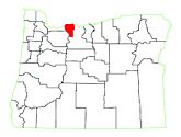
In 2005[1], a hydrodynamic and temperature model was developed with CE-QUAL-W2 for Laurance Lake in Hood River County, Oregon. The reservoir empties into the Middle Fork of the Hood River, and since Hood River currently violates temperature standards, a hydrodynamic and temperature CE-QUAL-W2 model was developed to assess strategies for improving temperatures in the Middle Fork River.
The objectives of this study were defined as:
- Develop a hydrodynamic and temperature model of Laurance Lake
- Calibrate the model to field data collected from November 2002 through Spring 2004
- Use the model to evaluate strategies for temperature improvement through operational or structural changes to Lake Laurance
Data Needs
- Geometry Data
- Lake bathymetry: Bathymetry was developed using depth soundings, a USGS digital elevation map (DEM), and a bathymetric contour map provided by the Middle Fork Irrigation District.
- Initial Conditions
- Initial Temperature: A single vertical profile was used for the initial temperature
- Boundary Conditions
- Meteorological data: Meteorological data was measured at the dam and at an agrimet station located in a nearby city.
- Daily outflows: The outflow file was developed from data provided by the Middle Fork Irrigation District (MFID)
- Daily inflows: Inflows were based on gaging station data. Where gaging data was not available, a regression equation was used.
- Inflow temperatures: Inflow temperatures were measured directly.
Monitoring Needs
- In-Pool/In-Situ Data
- Vertical temperature profiles: Temperature probes located along the dam were measured continuously over the simulation period.
- Water Budget
- Daily water level at upstream system boundary
